Minetta Creek
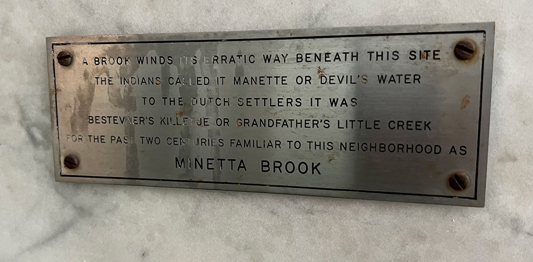
Near the entrance of the apartment building at Two Fifth Avenue there is a small plaque which reads:
A BROOK WINDS ITS ERRATIC WAY BENEATH THIS SITE
THE INDIANS CALLED IT MANETTE OR DEVIL’S WATER
TO THE DUTCH SETTLERS IT WAS
BESTEVAER’S KILLETJE OR GRANDFATHER’S LITTLE CREEK
FOR THE PAST TWO CENTURIES FAMILIAR TO THIS NEIGHBORHOOD AS
MINETTA BROOK
A creek or brook did once flow where this building is located before it became covered by the urban metropolis of New York City. The creek began from two tributaries just west of where Union Square is now and flowed southwest to the Hudson River. An 1865 map called the Viele Map shows its course overlayed on the streets which would later cover it.
One of these streets is the eponymously named Minetta Street, a short curved street only one block long from Bleeker Street to Minetta Lane, which seems out of place in the orderly grid around it. This is because the creek flowed exactly on its current path. As the city grew, this area developed from farms to multi-storied buildings. While people then didn’t have knowledge of viruses, they had a sense that unsanitary conditions contributed to disease, one of which was Yellow Fever, which ravaged the city in several epidemics. In the days before sewers and indoor plumbing, one can imagine how unsanitary the creek had become as the population grew around it.
In 1820, the decision was made to fill in and cover the creek. Although the creek would be gone from the surface, its source was not rain water, but underground springs. Thus, the creek would keep flowing underground and possibly still does today. There has been a lot of anecdotal evidence over the years to support this such as construction digs finding fresh flowing water and basements flooding.
So as you walk down Minetta Street and the surrounding area, think of the stream flowing under your feet that was once known as Devil’s Water.
Walk over the creek and learn more about New York history in the Secrets of Greenwich Village Tour.
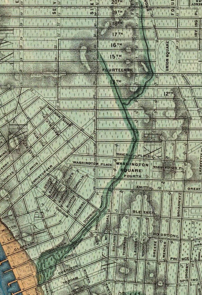
Minetta Creek on the 1865 Viele Map
Did you know the Viele Map covers all of Manhattan and is still used by civil engineers today to know where all the old waterways were?